 |
| Thanks to Padfield.com |
The Limes Tripolitanus
Tripolitana, the "Land of Three Cities"
The Limes Tripolitanus was a frontier zone of defence of the Roman Empire, built in the south of what is now Tunisia and the northwest of Libya. It was primarily intended as a protection for the tripolitanian cities of Leptis Magna, Sabratha and Oea in Roman Libya.
The Limes Tripolitanus was built after Augustus. It was related mainly to the Garamantes menace. Septimius Flaccus in 50 AD did a military expedition that reached the actual Fezzan and further south.
The Romans did not conquer the Garamantes so much as they seduced them with the benefits of trade and discouraged them with the threat of war. The last Garamantes foray to the coast was in AD 69, when they joined with the people of Oea (modern Tripoli) in battle against Leptis Magna.
The Garamantes started to become a client state of the Roman Empire, but nomads always endangered the fertile area of coastal Tripolitania. Because of this Romans created the Limes Tripolitanus.
The first fort on the limes was built at Thiges, to protect from nomad attacks in 75 AD. The limes was expanded under emperors Hadrian and Septimius Severus, in particular under the legatus Quintus Anicius Faustus in 197-201 AD.
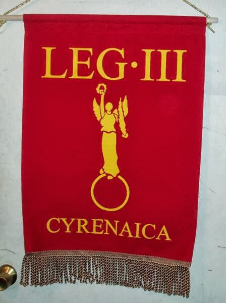
Anicius Faustus was appointed legatus of the Legio III Augusta and built several defensive forts of the Limes Tripolitanus in Tripolitania, among which Garbia and Golaia (actual Bu Ngem) in order to protect the province from the raids of nomadic tribes. He fulfilled his task quickly and successfully.
As a consequence the Roman city of Gaerisa, situated away from the coast and south of Leptis Magna, developed quickly in a rich agricultural area Ghirza became a "boom town" after 200 CE, when the Roman emperor Septimius Severus (born in Leptis Magna) had organized the Limes Tripolitanus.
Former soldiers were settled in this area, and the arid land was developed. Dams and cisterns were built in the Wadi Ghirza to regulate the flash floods. The farmers produced cereals, figs, vines, olives, pulses, almonds, dates, and perhaps melons. Ghirza consisted of some forty buildings, including six fortified farms (Centenaria).
With Diocletian the limes was partially abandoned and the defence of the area was done even by the Limitanei, local soldier-farmers. The Limes survived as an effective protection until Byzantine times. Emperor Justinian restructured the Limes in 533 AD.
From 665 to 689, a new Muslim Arab invasion of North Africa was launched. The limes fortifications played little part.
It began, according to Will Durant, to protect Egypt "from flank attack by Byzantine Cyrene." So "an army of 40,000 Muslims advanced through the desert to Barca, took it, and marched to the neighborhood of Carthage." A defending Byzantine army of 30,000 was defeated in the process.
Next came a force of 10,000 Arabs led by the Arab general Uqba ibn Nafi and enlarged by thousands of others. Departing from Damascus, the army marched into North Africa and took the vanguard. In 670 the city of Kairouan (roughly eighty miles or 160 kilometers south of modern Tunis) was established as a refuge and base for further operations.
This would become the capital of the Islamic province of Ifriqiya, which would cover the coastal regions of what are today western Libya, Tunisia, and eastern Algeria. Thus ended 800 years of Roman Africa.

 |
| Olive production and Roman water management. The Romans and Byzantines built dams and cisterns to capture the limited rain fall. Local farmers produced cereals, figs, vines, olives, pulses, almonds, dates, and perhaps melons. |
 |
| Suq al-Awty |
The Roman Centenarium of Suq al-Awty
- A Centenarium is an Ancient Roman fortified farmhouse in the Limes Tripolitanus. There were more than 2,000 of these fortifications. Retired legionaries received plots of land along the wadis, in arid areas and the countryside.
The first "Centenaria" were built during Trajan and Septimius Severus expansions of Roman Libya and Africa Proconsularis, when was created the Limes Tripolitanus.
From around the time of disbandment of the Legio III Augusta in 238 AD, legionaries built around two thousand centenaria in the areas around Leptis Magna and Sabratha. Examples remain at Gherait esh-Shergia and Gasr Banat. Some were characterized by the presence of paleochristian churches.
The "Centenaria" system of production, based on autochthonous berbers who were partially Latinized and often even Christians, was successful and worked very well until Byzantine times. Centenaria remained in use for several centuries after the Arab conquest in the second half of the seventh century, until the system collapsed in the eleventh century.
There is much conjecture about the origin of the word "centenarium". Probably their Latin name was due to the fact that one hundred men (one hundred is said in Latin "centum") worked each fortified farm, under the orders of a former army "centurion".
 |
| The Wadi Bruza and three Roman centenarium fortified farms. |
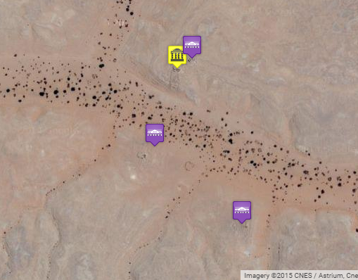
Suq al-Awty
On one of the northern spurs along the wadi is a large complex, known as Suq al-Awty, in which five constructions can be discerned. Two fortified farms, two cisterns and a church.
The northernmost fortified centenarium (above photo) was measured as 20 x 20m with rooms situated around a small central square. Ceramics show that the place was settles in the second century and so actually predate the construction of the Limes Tripolitanus.
The southern centenarium (photo 904 below) has an extremely heavy eastern wall and the building is about seventeen meters long. Access was possible through a vaulted passage. The outside was decorated. It is as old as the first building. These fortified farms were surrounded by huts.
A vaulted cistern was built on the southern slope of the hill. The structure, made of plastered rubble, must have served to collect the rain water that fell on the hill itself. It is a pretty deep structure and was erected on, not dug in the slope.
Church - The main monument is the church dating from the early Byzantine period. It is about 23m long, has three barrel-vaulted aisles and is almost 13m wide. A baptistery has been identified. Water must have been obtained from the nearby cisterns. The people who visited the church came in from a wide area including a village some six km to the west.
The church was decorated with sculpture and frescoes. There are also some graffiti including a representation of a water vessel. A bit odd in a small village in a desert that produced cereals and olives.
 |
| Emperor Constans II The last Roman Emperor of Tripolitanus |
Suq al-Awty and the two centenaria were abandoned in the second half of the seventh century. This may have been a direct result of the Arab conquest. The church may have been a special target.
Across the Wadi - There were two fortified farmson the south bank of Wadi Burza. One of them may have had three stories. The heavy walls, made of coursed rubble, were about a meter in diameter. There were many people living here with at least twelve rooms in the building. There were many cisterns in the neighborhood.
After Rome
Except for a new religion, the predesert civilization that was based on careful water management and constant vigilance remained the same. It was only in the eleventh century, when two Arabian dynasties, the Zirids and the Fatimids, were involved in a major war, that the system collapsed. After the garrisons had been transferred from the cities to the front, nomads of Banu Hillal tribe could capture the qsur. The agricultural production declined rapidly, the cities were no longer fed, and the remaining town dwellers abandoned Lepcis Magna and Sabratha to settle in Oea, which was from now on known as Tripoli.
The twelfth-century Sicilian geographer Muhammad al-Idrisi writes:
"Until recently, the Tripolitana was well-exploited and covered with fig trees, olives, dates palms, and other fruit trees. But the Arabs have completely destroyed this prosperity. The peasants were forced to leave the country, the orchards were destroyed, and the canals were blocked." - - - Al-Idrisi, Roger's Book, 121.
What had for eight centuries been a wealthy province of the Roman, Byzantine, and Muslim empires, now became a desert again. The decline of the population meant that there was no one who could destroy the ancient cities, the qsur, the watchtowers, the forts. They were simply left as they were, until nine centuries after the collapse, the first archaeologists started to study them.
 |
| Map of Wadi Buzra (Livius.org) |
 |
| Suq al-Awty (Bz 904) (Livius.org) |
 |
| Suq al-Awty, cistern |
 |
| Suq al-Awty, church |
 |
| Suq al-Awty, church |
 |
| View across the wadi |
(Suq al-Awty) (Tripolitania) (Centenarium) (Limes Tripolitanus)
(Limes Tripolitanus) (Suq al-Awty) (Roman Libya)
5 comments:
The last Garamantes foray to the coast was in AD 69, when they joined with the people of Oea (modern Tripoli) in battle against Leptis Magna.
resume
very fine blog . many hours of mesmerizing past , and adventures . very good work , and very well writhing .
The twelfth-century Sicilian geographer Muhammad al-Idrisi writes:
"Until recently, the Tripolitana was well-exploited and covered with fig trees, olives, dates palms, and other fruit trees. But the Arabs have completely destroyed this prosperity. The peasants were forced to leave the country, the orchards were destroyed, and the canals were blocked." - - - Al-Idrisi, Roger's Book, 121.
well , as in Surya nowadays
Heeeeeeeeeeellllllllllllllllllllllllllllllllllloooooooooooooooooooooooooo !!!!!
quem está de serviço ao fórum ?
Great readingg your blog
Post a Comment